
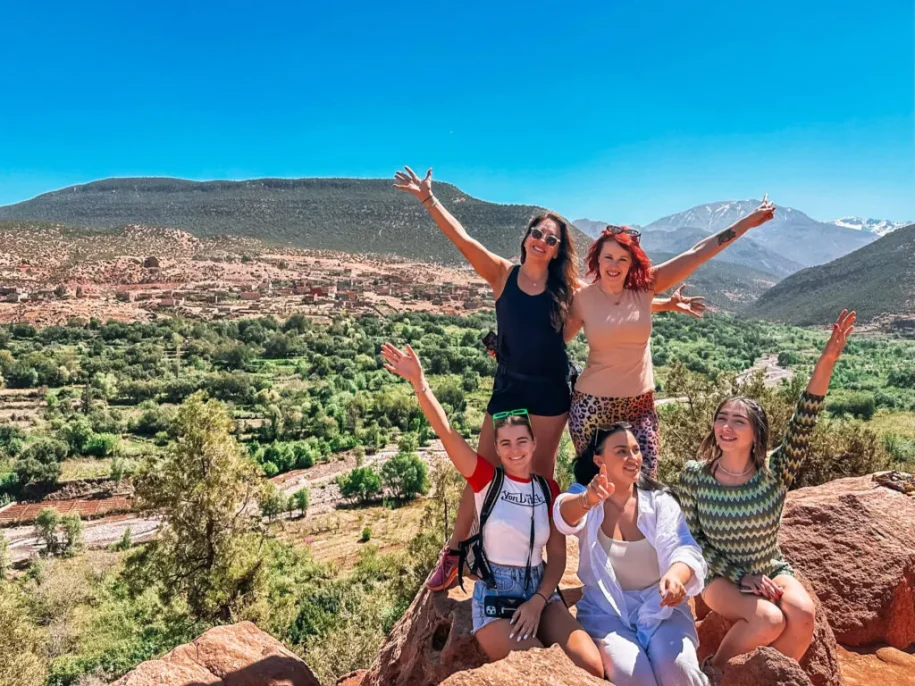
The Agafay is the stone desert that begins about forty minutes south-west of Marrakech. It is the closest thing to a desert you can reach from the city and be back for dinner, and it is also one of the most confidently described and least documented landscapes in Morocco. This page separates what can be stated from what is repeated.
What the Agafay Desert Actually Is
The Agafay is a stone desert, not a sand one. Travel writing and geographic descriptions converge on the same picture: undulating rocky plateaus, hills of grey and ochre marl and clay, dry riverbeds, and no dune field anywhere. The technical labels used for this kind of terrain are reg and hamada, and the sources use them more or less interchangeably without settling the distinction.
What you see on the ground is a surface of compacted clay and gravel, scoured by wind, with the High Atlas closing the southern horizon. In winter those peaks carry snow, which produces the contrast the Agafay is photographed for: bare ochre hills in the foreground, white mountains behind. There is no oasis, no palm grove and no sand sea. The emptiness is the attraction, and it is what the camps are built to frame rather than to furnish.
Where It Sits, and How Far That Really Is
The plateau lies roughly 30 to 40 kilometres south-west of Marrakech, in the foothills of the High Atlas. The drive takes 40 to 45 minutes from the medina, and the last stretch to most camps runs on unpaved piste rather than tarmac, which is why a registered transfer is more reliable here than a rental car.
That proximity is the whole point of the place. You can leave your riad after breakfast, ride a camel, eat lunch under a tent, swim at a camp pool, watch the sun drop behind the Atlas and sleep in Marrakech. No other desert landscape in the country sits that close to a major city, and it is the single fact that explains why the Agafay exists as a destination at all. For exact distances and driving times from different parts of the city, we keep a dedicated page: how far the Agafay Desert is from Marrakech.
Why It Is Not the Sahara
This is the most common misunderstanding about the Agafay, and the most important one to clear up before booking. The Agafay is not part of the Sahara. It is a rocky plateau on the edge of the Atlas, not an erg, and nothing about its surface resembles the dune fields people picture when they say desert.
The nearest true Saharan dunes are more than 500 kilometres further south, at Merzouga and Erg Chigaga. Reaching them means a three-day trip at minimum, with two long driving days. Travellers who arrive in the Agafay expecting golden dunes are the ones who leave disappointed, and they are right to be, because that is not what it is. Knowing which of the two you are booking is the single most useful thing to settle before you pay. We treat the question at length on its own page: is the Agafay Desert part of the Sahara?
The Ground Under Your Feet
Walk a few hundred metres from any camp and the surface tells you what this landscape is made of. Underfoot there is hard-packed clay, loose gravel and flat stone, with fine material largely stripped away by wind. Geographers call that result a desert pavement: the light particles blow off, the coarse ones stay, and what remains is a hard armoured surface that resists further erosion.
The hills themselves are marl and clay rather than rock in the mountain sense. They are soft enough to be carved into rounded, almost smooth shapes, which is where the comparisons to a lunar landscape come from. In practice this matters for your footwear more than for your photographs. Closed shoes hold on loose gravel; sandals do not. It also explains why the pistes deteriorate quickly after rain, and why camps regrade their access tracks each winter.
What Is Not Established About How It Formed
Here we have to be straight with you, because almost nobody else is. We could not find a published geological study of the Agafay plateau describing how it formed, when, or from which deposits. The regional geology of Morocco is well documented, including the basins and fault blocks created as Pangaea rifted apart through the Mesozoic. What is missing is the link between that regional story and this particular plateau.
So the honest position is this: the Agafay’s surface materials are observable and consistently described, and its formation history is not. A formation age, a depositional mechanism and a stratigraphic unit would all need a source we have not found. Anyone offering you those three things in a paragraph is very likely reciting another travel page rather than a geological survey. We would rather leave a gap on this page than fill it with a confident sentence we cannot stand behind.
The Prehistoric Lake Story
You will read, on a great many sites, that the Agafay was once a prehistoric lake that dried up thousands of years ago, leaving a mineral-rich basin of clay and stone. It is a tidy explanation, it fits the look of the place, and it is repeated almost everywhere.
We do not repeat it, because we have not found a geological source behind it. It appears in travel guides and tour descriptions, never attached to a study, a survey map or a named researcher. That does not make it false. It makes it unverified, which is a different thing, and the difference matters on a page whose job is to tell you what is known. If you come across a Moroccan geological survey of the Haouz plain that settles it, we will update this section and say where it came from.
Who Lives and Works Here
The Agafay was grazing land long before it was a destination. Accounts from the region describe Berber shepherds moving goats and sheep across the plateau for generations, with small-scale cultivation on the fringes where seasonal watercourses allow it: olives, cereals, a few vines. Some accounts mention settlements abandoned for lack of water, leaving only herders behind.
We give this as what it is: a consistent picture drawn from travel writing and local description, not from historical research. You will still see the herding today. Flocks cross the pistes, and shepherds appear on ridgelines where there seems to be nothing to eat. The camps and the activity operators arrived recently by comparison, in the last fifteen years or so, and they sit on a landscape that was already in use. That is worth remembering when a camp describes itself as remote: the plateau has been worked for far longer than it has been visited.
The Name Itself Is Undocumented
We looked for the meaning of the word Agafay and did not find a source that establishes it. The name is Amazigh in form, like most place names in this part of Morocco, and it appears locally as Sahraa Agafay. Beyond that, the etymologies offered online are assertions without references.
This is worth a short section only because the absence is itself informative. The Agafay is a place that tourism discovered recently and documented thinly. Its camps have websites; its geology and its name do not have bibliographies. When you are reading about it, including here, it is worth knowing which statements rest on observation, which rest on our own operating experience, and which rest on repetition. On this page we have tried to keep the three apart, and to say so when a question simply has no answer we can source. It is a short section because the record is short, not because the question is unimportant.
Climate: Two Deserts in One Year
The Agafay is effectively two different places depending on the month. From roughly October to May it is comfortable in the daytime and cold after dark, with the clear skies that make the plateau worth sleeping on. In July and August, afternoons frequently pass 40 °C, and the middle of the day becomes something to plan around rather than through.
That seasonality drives every practical decision: the hour you book an activity, whether you want a camp with a pool, how much warm clothing you pack for a night under canvas. Desert nights cool fast in every season, including summer, which surprises people more than the heat does. We keep the month-by-month detail on a separate page: Agafay Desert weather and best time to visit, and a packing list in what to wear in the Agafay.
Water, and Riverbeds That Are Not Always Dry
The dry watercourses crossing the plateau are a real feature of the landscape rather than scenery. They run after rain, sometimes hard, and they are the reason the pistes need regrading and the reason cultivation survives on the fringes at all. The nearby reservoir at Lalla Takerkoust, west of the plateau, is the visible water in the area and a common stop on longer itineraries.
For a visitor this matters in two narrow but practical ways. Rain makes the final kilometres of piste genuinely difficult for an ordinary car, which is one more argument for a vehicle that does this route daily. And a wet week changes the colour of the hills: the clay darkens, and a thin green appears on slopes that look sterile the rest of the year, which is why spring photographs of the Agafay rarely match what you find in August.
Essential Facts at a Glance
| Agafay Desert | |
|---|---|
| Type of landscape | Stone desert (reg / hamada), no dunes |
| Distance from Marrakech | 30 to 40 km south-west |
| Driving time | 40 to 45 minutes from the medina |
| Surface | Marl and clay hills, gravel, dry riverbeds |
| Backdrop | High Atlas, snow-capped in winter |
| Nearest true Sahara dunes | Merzouga or Erg Chigaga, over 500 km south |
| Comfortable season | October to May |
| Summer afternoons | Frequently above 40 °C |
| Last access | Unpaved piste to most camps |
| Documented geology | None found in accessible sources |
Every line above is either observable on site or drawn from our own operating experience. The last one is the one most pages leave out. Two figures are deliberately absent because we could not source them: the plateau’s altitude and its surface area. Both are quoted confidently elsewhere, with numbers that disagree with each other, and we would rather print nothing than pick whichever sounds best.
What There Is to Do, and What It Costs
The activities are short and the prices are fixed, which makes the Agafay easy to budget before you arrive. A camel ride is 30 € per person for about an hour. A quad is 35 € for one hour and 55 € for two; a buggy is 100 € and 140 € for the same, and it carries two people. A pool day pass starts at 65 € per person.
Most visitors combine rather than pick one, and the combinations are priced as a package: camel and lunch 71 €, quad and camel 61 €, quad, camel and lunch 104 €, buggy and camel 123 €. Staying the night at one of the camps we book, among them Agafay Dome, Agafay Pearl, Dar Ina and Nkhila, is 120 € per person. The full breakdown sits in our Agafay activities and prices guide, and the catalogue in Agafay Desert tours.
Getting There
Marrakech petit taxis are not permitted to leave the city, so the practical options are a private transfer, a rental car, or the transport included in an organised activity. We quote the private transfer at 80 € per car, one way or for a return made the same day, which covers a day visit or a dinner. One car takes up to six passengers, so the cost per head falls as the group grows.
If you sleep at a camp and return the following day, the transfer is 160 €, because the car makes two separate journeys. Whatever you choose, the final kilometres on piste are the part people underestimate: a standard rental car can reach some camps and will struggle at others, and it is worth confirming which before you drive yourself out of the city.
Frequently Asked Questions
Is the Agafay a real desert?
Yes, in the sense that matters on the ground: it is an arid, largely bare stone landscape with desert pavement, dry riverbeds and no permanent vegetation beyond scrub. It is not a sand desert, and it is not part of the Sahara.
How was the Agafay formed?
We do not know, and we have not found a published geological study that answers it. The widely repeated story of a dried-up prehistoric lake appears in travel writing without a source behind it.
What does the word Agafay mean?
No source we could find establishes the etymology. The name is Amazigh in form and appears locally as Sahraa Agafay.
How far is it from Marrakech?
Between 30 and 40 kilometres south-west, which is 40 to 45 minutes of driving from the medina, with the last stretch on unpaved piste.
When is the best time to go?
October to May for daytime comfort. In July and August, plan activities for early morning or late afternoon, or choose a camp with a pool.